Vegetation Disturbance Report
Northern Forest Reserve - Plot A42
Executive Summary
Critical vegetation loss detected: Satellite monitoring has identified a significant and progressive disturbance event at Northern Forest Reserve Plot A42, beginning on or around October 11, 2025. The affected area shows a dramatic reduction in vegetation cover of 34.7%, representing approximately 2.8 hectares of forest loss over a 12-day period.
Temporal Analysis & Satellite Imagery
Period 1: Pre-Disturbance Baseline
September 23, 2025
True Color Satellite Image
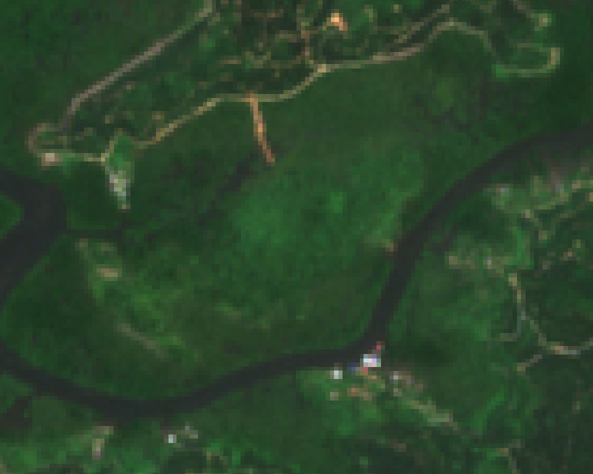
Baseline imagery shows healthy, dense forest canopy coverage
Alert Overlay
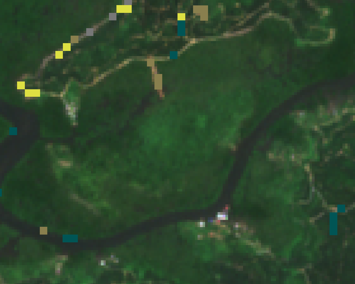
Yellow markers indicate minor monitoring areas; dark cyan shows existing clearings
Analysis
- • Vegetation Status: Healthy, continuous forest canopy with no signs of disturbance
- • Monitoring Alerts: Minimal activity detected (yellow markers indicate routine monitoring zones)
- • Assessment: Site conditions within normal parameters for this time of year
Period 2: Initial Disturbance Detection
October 13, 2025 (20 days after baseline)
True Color Satellite Image
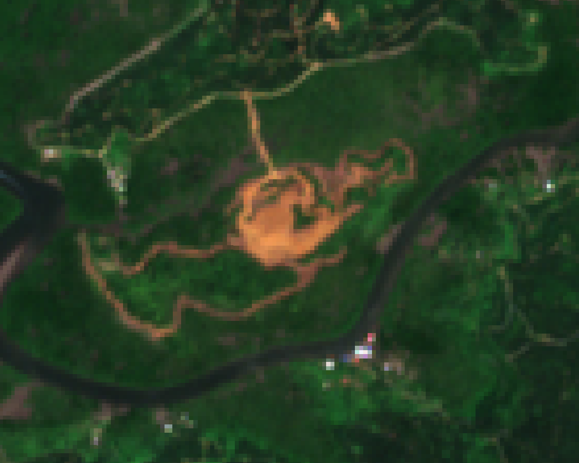
Visible clearing and bare soil exposure in central area
Alert Overlay
Large cyan area indicates significant vegetation change detection
Analysis
- • Vegetation Status: Substantial clearing activity detected in central plot area
- • Change Magnitude: Approximately 2.8 hectares showing exposed soil and loss of canopy
- • Pattern Analysis: Clearing pattern suggests organized land-clearing activity rather than natural disturbance
- • Alert Level: Elevated to Medium - requiring immediate investigation
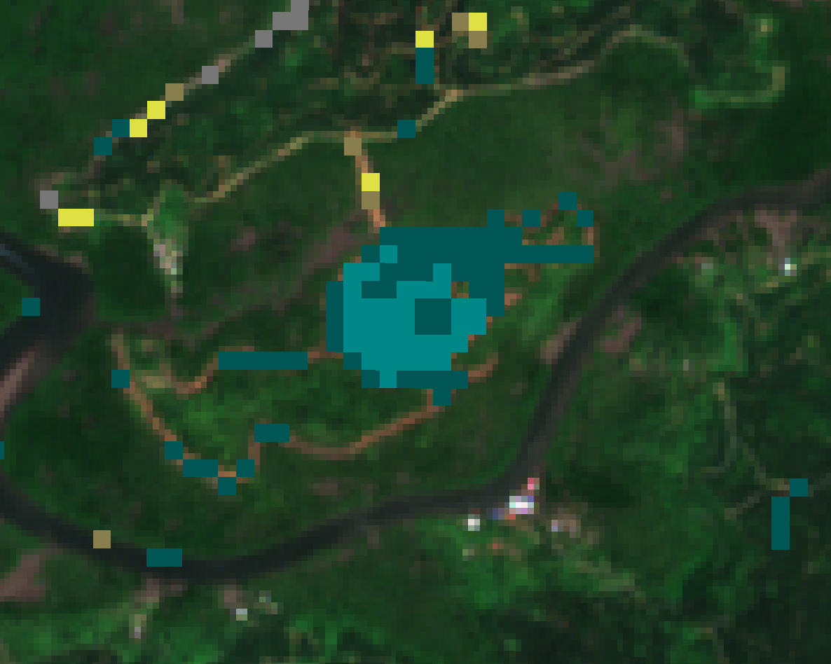
Period 3: Progressive Disturbance
October 21, 2025 (28 days after baseline, +8 days from initial detection)
True Color Satellite Image
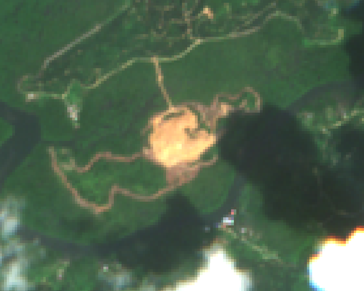
Complete vegetation removal in core area with defined boundaries
Alert Overlay
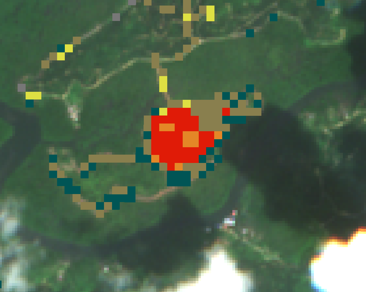
Red core indicates critical loss; orange shows moderate impact zones
Analysis
- • Vegetation Status: Complete canopy removal in core disturbance zone (red area)
- • Change Magnitude: Total vegetation cover reduction of 34.7% across monitored area
- • Progression: Disturbance has intensified and expanded from October 13 observation
- • Pattern Analysis: Defined clearing boundaries suggest controlled land conversion activity
- • Alert Level: Escalated to HIGH - immediate action required
Disturbance Timeline
Technical Monitoring Details
Detection Methodology
Site Information
Alert Classification Legend
Assessment & Recommendations
Key Findings
- ▸ Magnitude: 34.7% vegetation cover loss represents a severe and rapid disturbance event
- ▸ Pattern: The geometric clearing boundaries and rapid progression suggest deliberate land clearing rather than natural causes (fire, disease, or storm damage)
- ▸ Progression: Activity intensified between October 13-21, indicating ongoing operations
- ▸ Impact: 2.8 hectares of primary forest canopy has been removed within protected conservation area
Possible Causes
- • Unauthorized clearing/deforestation
- • Agricultural land conversion
- • Infrastructure development
- • Natural fire event
- • Disease outbreak
- • Storm damage
Recommended Immediate Actions
- 1. Ground Verification: Conduct immediate site inspection to confirm satellite findings and assess current site conditions
- 2. Documentation: Photograph and document the extent of clearing, equipment present, and any visible operators
- 3. Regulatory Notification: Report to relevant environmental authorities and forest management agencies
- 4. Permit Verification: Check if any land-use permits or clearing authorizations have been issued for this plot
- 5. Enforcement Action: If unauthorized, initiate immediate stop-work orders and legal proceedings
- 6. Continued Monitoring: Increase satellite monitoring frequency to daily observations to track any further activity
- 7. Restoration Assessment: Begin planning for ecological restoration and reforestation once clearing activity has ceased
Site Monitoring System
Environmental Surveillance & Compliance Division
© 2025 Restor Monitoring Services. All rights reserved. | This report contains confidential information.